LAND O’ LAKES — Pasco County is addressing one of central Pasco’s busiest thoroughfares, studying whether extending it and connecting it with other existing roads makes sense.
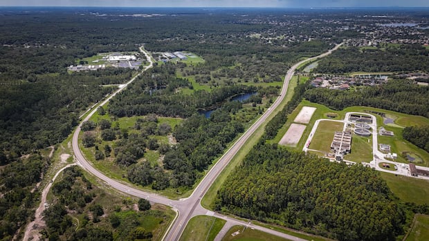
On June 17, county commissioners approved the Collier Parkway Extension Route Study. The project would extend Collier Parkway — which becomes Parkway Boulevard before ending at Ehren Cutoff — from just above the Cypress Creek Preserve to State Road 52.
The study will analyze alignment alternatives through environmental and residential areas. Planning and design consulting firm Kimley-Horn will conduct the work.
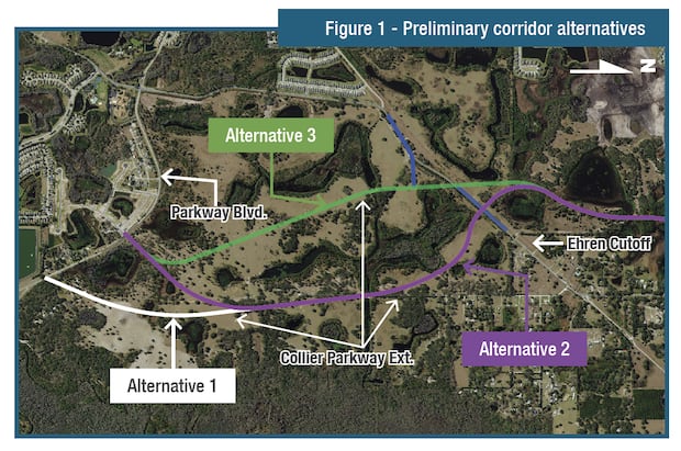
At the meeting, Kimley-Horn submitted materials outlining plans that identify at least three alternative routes. All run about 3.5 miles to State Road 52, south of the Connerton development to the Cemex plant on Ehren Cutoff.
The extension would be a four-lane road with 5-foot bike lanes, curbs and gutters, a 22-foot median, a 5-foot sidewalk, and a 12-foot multi-use path.
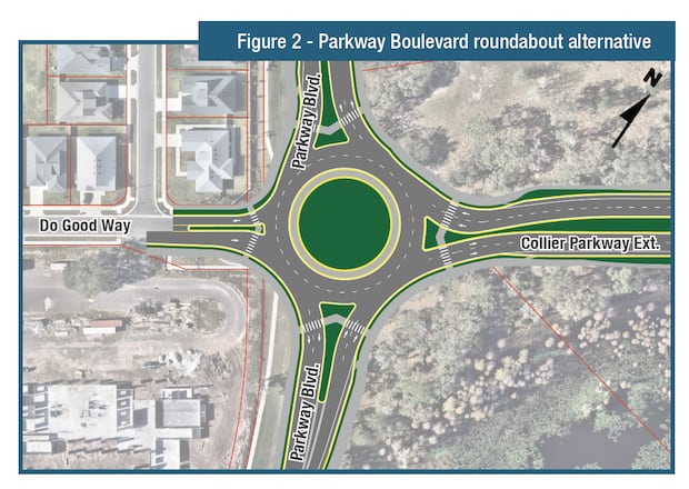
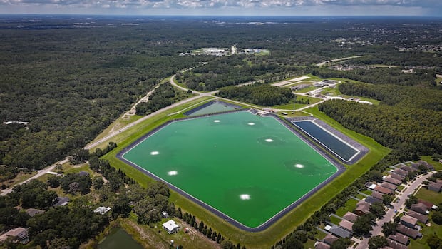
According to Kimley-Horn, the three alternative routes under consideration include one starting near the Land O’ Lakes Sub Regional Wastewater/Reuse Facility by a small road named Regina Place. The other two routes would start by creating a new intersection or roundabout at Do Good Way, the main entrance to the Tunnel to Towers Do Good Village — a community of more than 100 mortgage-free homes given to families of fallen military members and first responders.
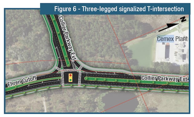
Each route connecting with Ehren Cutoff would “introduce several unique design and operational challenges” because the “corridor experiences a mix of industrial traffic, including trucks accessing the (Cemex) plant, as well as local and commuter traffic, creating the need for a safe and efficient intersection design.”
The connection would create either a lighted T-intersection, a three-way roundabout, a Y-intersection with merging lanes or a T-intersection realignment.
Eight potential intersections will be evaluated during the route study, including connections to Parkway Boulevard, two locations along Ehren Cutoff, Nebula Way, Connerton Boulevard, Pondered Day Lane, Pasco Village Parkway and S.R. 52. The potential realignment of the Ehren Cutoff and Collier Parkway intersection also is being considered.
According to Kimley-Horn, this skewed intersection presents several issues, including limited sight distance for drivers, particularly when making turns or navigating through the intersection at sharper angles. The materials state: “The alignment forces drivers to glance over their shoulders to avoid potential conflicts, which could lead to safety hazards. Additionally, the angle may complicate the turning radii for larger vehicles, increasing the potential for traffic conflicts and delays.”
The analysis will assess appropriate traffic control strategies for each intersection using 2024 traffic data from the Tampa Bay Regional Planning Model. According to that data, Parkway Boulevard just west of Collier Parkway has approximately 1,700 vehicles per day. Ehren Cutoff north of Parkway Boulevard has approximately 7,400 vehicles per day, decreasing to 5,800 vehicles per day just south of S.R. 52.
The regional planning model only projects traffic volumes to 2045, so projections to 2055 will be done using software during this project’s traffic analysis phase. By 2045, the model shows Collier Parkway with approximately 4,400 vehicles per day north of Parkway Boulevard, increasing to 7,500 vehicles per day north of Ehren Cutoff and 14,900 vehicles per day north of Connerton Boulevard, then decreasing to 6,800 vehicles per day near the northern terminus.
By 2045, Ehren Cutoff is projected to have approximately 13,800 vehicles per day south of the first intersection with Collier Parkway, decreasing to 10,700 vehicles per day until Connerton Boulevard, then 7,500 vehicles per day to the north and 14,400 vehicles per day north of where Collier Parkway would merge into Ehren Cutoff up to S.R. 52.
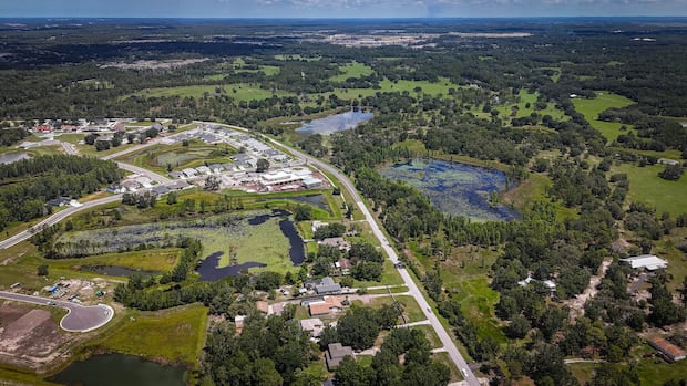
The materials also address pond siting and hydraulic analysis, as the project would traverse many interconnected floodplains that primarily west to east toward Cypress Creek. From south to north, the corridor crosses three Florida Department of Environmental Protection-mapped water body basins: Cypress Creek North, Fivemile Creek, and Ehren Cutoff Creek.
Kimley-Horn’s goal “will be to select an alignment that minimizes floodplain impacts to reduce or eliminate the need for floodplain compensation by providing cross drain connections and demonstrating no rise in floodplain elevations upstream or downstream of the crossing.”
Within the Southwest Florida Water Management District permit for Connerton, the proposed roadway alignment includes stormwater pond conveyance systems for the southern 2.2 miles of the extension. Cross drains have also been preliminarily designed to provide conveyance under the corridor to pond sites, Fivemile Creek and wetlands within portions of the corridor through Connerton.
A large wetland near the south end of Connerton and another just south of Fivemile Creek will require evaluation of alternatives to minimize wetland and floodplain impacts. Alternatives for crossing these areas include filling with installation of cross drains to maintain conveyance, though any resulting floodplain impacts will require appropriate compensation. Additional alternatives include bridge crossings, larger box culverts and the use of a contained roadway rise.
However, Kimley-Horn noted that “identifying suitable areas for floodplain compensation may be challenging, since much of the surrounding land is slated for development.”